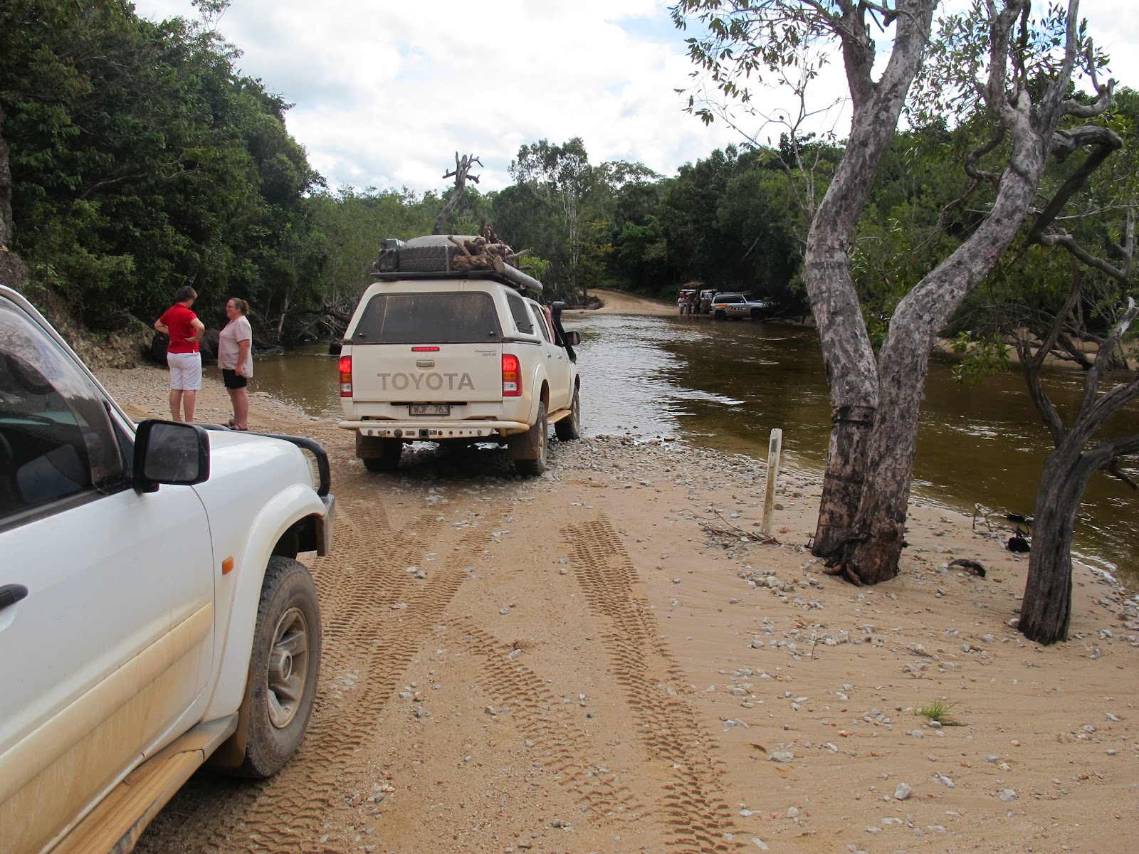
We left Bramwell Station and then refuelled at Bramwell Junction which is the start of the Old Telegraph Track.
One regular casualty is a vehicle's numberplates and the Junction Roadhouse has a selection of them nailed to a tree.
We then headed off up the Tele to see how far we would get. The answer is not very far! The first creek crossing is Palm Creek and while the water is not deep the approach and exit tracks are wet, muddy, slippery, steep and generally damned difficult.
Check out the pics below and note that only one vehicle made it through without needing to be winched - that was a Patrol with a big lift, double locked and wearing Centipedes - all very serious gear indeed,
This particular dickhead attacked the exit repeatedly and ended up breaking his steering.
So, we continued up the bypass road and then turned in to the Eliot Falls camp ground. The track in was rough and this crossing was one of them on the way in.
We got to the Eliot Falls campground and found that the QLD Nat Parks people had stuffed up our booking (no big surprise) and ut all four of us on a site that was barely big enough for two tents. I called them on the satphone and spent $25 in call fees while they stuffed around (and ultimately stuffed up again) re-organising things.
Still, the falls were spectacular:
Twin Falls - these are probably the most well known of the falls and they provide a brilliant swimming hole with the clear green water and the falls themselves.
Take a look and enjoy!
This was the fall that takes the water out of the swimming hole.
Just to give you some perspective, this is Karen heading in for a swim.
I enjoyed the massage effect from the falls themselves!
I wonder if Hugh Jackman is worried about his "Sexiest Australian Man" title now? Hmmmm?
Eliot Falls were a short walk away and we were very impressed with them.
This is the view upstream and while most of the water is just six inches deep over the rock you can see where the deeper holes are to be found - and we found them!
Yep - these are the deeper holes in the river bed and they were ust so refresshing to swim in.
Fruit Bat Falls were a bit of a drive away and look to provide an even better swimming hole, but we didn't bring our togs so no swim that day.
Pretty though eh?
One of the days we went to drive further p the Tele Track and we came across some of the creek crossings. The first one was Sam Creek and we both took a drive through the water there.
Having seen Greg fall into a bit of a hole I stayed closer to the right hand bank and walked through the crossing easily.
Cannibal Creek was the next one and driving across the rock was simple as.
Sadly, after that the "girls" decided that we had done enough scary river crossings and insisted we went back to camp and the waiting beer and wine (and vodka) for the evening.
Friday, June 22, 2012
Cape York - Bramwell Station
It was with some regret that we left Chili Beach, but there are always more challenges ahead.
This a the Wenlock crossing again where we decided to take on some water straight from the river to replace the water we used at Chili.
Back on the PDR we headed north as far as Bramwell Station where we staed for the night.
What a magic place this is! Lots of space, great facilities and a bar and restaurant.
They also have a pet brolga which found itself locked into the small cemetery plot.
This a the Wenlock crossing again where we decided to take on some water straight from the river to replace the water we used at Chili.
Back on the PDR we headed north as far as Bramwell Station where we staed for the night.
What a magic place this is! Lots of space, great facilities and a bar and restaurant.
They also have a pet brolga which found itself locked into the small cemetery plot.
Cape York - Chili Beach
Leaving Coen we headed up the PDR and found out why people tell you to pay attention to the "Dip" signs - some of them are horrendous!
After a few klms we took on fuel at Archer River where the fuel price had risen to $2.20 a litre. Not really happy about that but what can you do apart from pay it.
We took the Lockhart River turnoff to Chili Beach and soon found more river crossings. This one is the Wenlock River and despite the crocodile warnings we found some people (on the far bank) letting their kids play in the water.
We had a chat with them about conditions and whether we could hit the Frenchman's Track on the way out. They took one look at my A/T tyres and said that I wouldn't make it.
Bugger!
We stopped for lunch soon after and this is Karen, Simone and Greg.
We soon entered the Iron Range NP and passed the tallest peak in the area.
Once through the range itself we again found ourselves in a varying landscape of rainforest then eucalypt forest and then some lush green meadows like the one below.
Strange place indeed, but interesting.
We found the Chili Beach camp area and set up home for a few nights. This is our place below.
And this is the other side of the site with direct access to the beach itself.
We had brought firewood in with us but we found that coconuts also make a great fuel for the camp fire
Just up the coast from Chili is the small town (and bay) of Portland Roads. There is a really nice little cafe there serving all sorts of home cooked delights. We had coffees with a lemon cheesecake and a frozen chocolate pecan pie. Yummy beyond belief, and the view from the balcony was gorgeous - check it out!
The place was a tropical paradise.
. . . . . but not for some people. The history of the place is not always kind.
We also took a drive into the indigenous community at Lockhart River to buy a couple of things.
I have to say that this was the tidiest and cleanest aboriginal camp we have seen. Perhaps it is the fact that it is a dry camp that makes the difference.
Back at camp we found that Simone had been practicing her damper baking and had produced a magnificant loaf to accompany dinner that night.
Chili Beach - well I had to take a few photos just to record what it is like.
This is the northern end at low tide where there are some large boulders on the sand
And looking towards the south you get a different view - all white sand, blue ocean and coconuts.
After a few klms we took on fuel at Archer River where the fuel price had risen to $2.20 a litre. Not really happy about that but what can you do apart from pay it.
We took the Lockhart River turnoff to Chili Beach and soon found more river crossings. This one is the Wenlock River and despite the crocodile warnings we found some people (on the far bank) letting their kids play in the water.
We had a chat with them about conditions and whether we could hit the Frenchman's Track on the way out. They took one look at my A/T tyres and said that I wouldn't make it.
Bugger!
We stopped for lunch soon after and this is Karen, Simone and Greg.
We soon entered the Iron Range NP and passed the tallest peak in the area.
Once through the range itself we again found ourselves in a varying landscape of rainforest then eucalypt forest and then some lush green meadows like the one below.
Strange place indeed, but interesting.
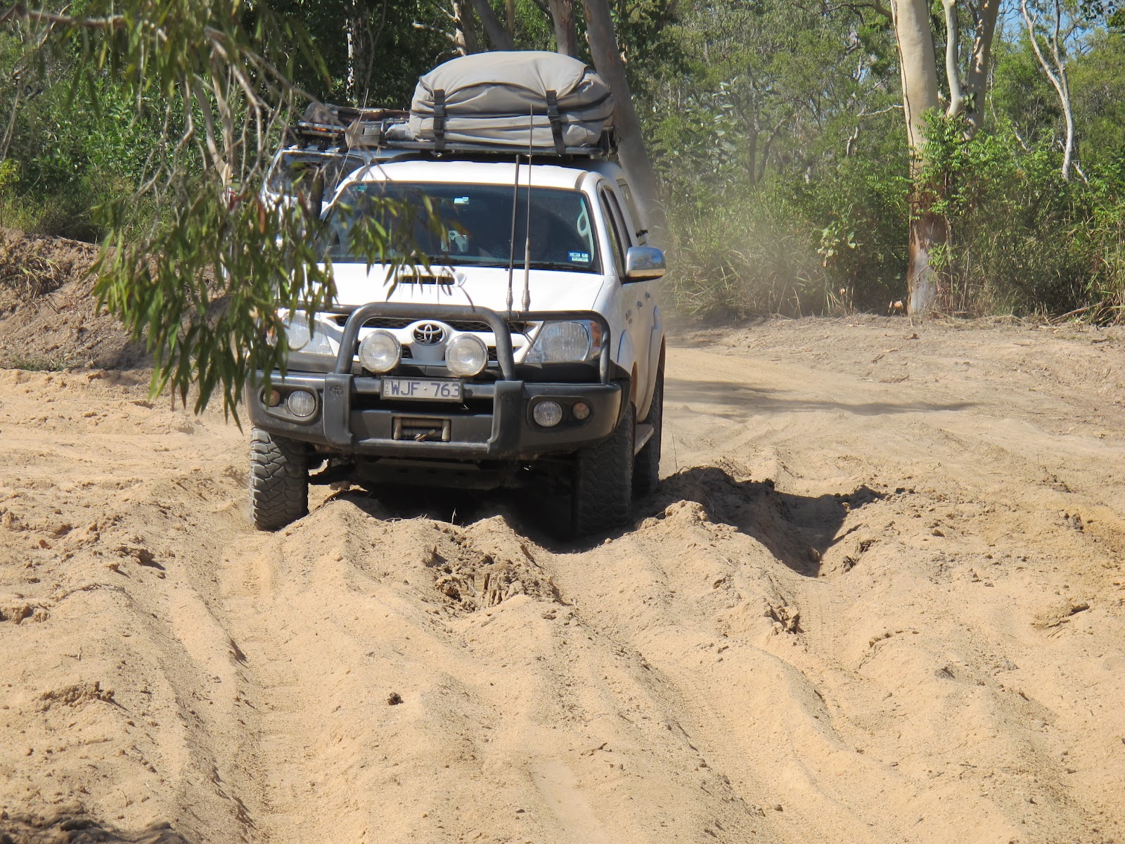
We found the Chili Beach camp area and set up home for a few nights. This is our place below.
And this is the other side of the site with direct access to the beach itself.
We had brought firewood in with us but we found that coconuts also make a great fuel for the camp fire
Just up the coast from Chili is the small town (and bay) of Portland Roads. There is a really nice little cafe there serving all sorts of home cooked delights. We had coffees with a lemon cheesecake and a frozen chocolate pecan pie. Yummy beyond belief, and the view from the balcony was gorgeous - check it out!
The place was a tropical paradise.
. . . . . but not for some people. The history of the place is not always kind.
We also took a drive into the indigenous community at Lockhart River to buy a couple of things.
I have to say that this was the tidiest and cleanest aboriginal camp we have seen. Perhaps it is the fact that it is a dry camp that makes the difference.
Back at camp we found that Simone had been practicing her damper baking and had produced a magnificant loaf to accompany dinner that night.
Chili Beach - well I had to take a few photos just to record what it is like.
This is the northern end at low tide where there are some large boulders on the sand
And looking towards the south you get a different view - all white sand, blue ocean and coconuts.
Cape York - Coen
Greg commented that the Patrol was blowing a lot of black smoke and it is certainly chewing through the fuel so when we reached Coen I had the local mechanic take a look at it.
He couldn't find anything obviously wrong so we decided to stop the night and camp out the back of the Exchange Hotel. Some wag has added an "S" to the name up on the roof though!
Camping fees were $5 per person and we ended up having a few beers in the pub anyway.
The next morning we had suffered the heaviest dew I can remember and it was COLD too. Time to move on!
He couldn't find anything obviously wrong so we decided to stop the night and camp out the back of the Exchange Hotel. Some wag has added an "S" to the name up on the roof though!
Camping fees were $5 per person and we ended up having a few beers in the pub anyway.
The next morning we had suffered the heaviest dew I can remember and it was COLD too. Time to move on!
Cape York - Lakefield
We spent a few nights in Cooktown (see previous posts) and then decided to head off to the top of Cape York with a couple we met in Cairns - Simone and Greg. They were leaving their van in Cooktown and tenting in just the same way that were plan to go.
The morning we left I spotted a few shafts of sunlight beaming through the trees and couldn't resist taking a photo or two.
This one has a wallaby sitting in the middle of a clearing - pretty eh?
On the other side of the van park were a stand of melaleucas (paperbark trees) and I tok a pic of those as well.
We headed north down the Battle Camp track and into Lakefield National Park. It is a beautiful place and we were amazed at how the vegetation could change within a few metres depending upon the soil .
We also started to come across the first of the river crossings we would see on this part of the trip.
This one was important because not only was it the first, but because it is the Laura River and our daughter is Laura it made us think a bit.
Well the actual crossing was not exactly difficult as you can see below, but all these crossings demand some respect as you never know how soft that sand might be!
Yeah - I couldn't resist taking a photo of Karen at the river's edge.
We camped the night at the Kalpowar river crossing and came across the injustices of the new QLD e-booking system in action for the first time.People not knowing about the new system and other people occupying booked sites etc - the whole thing is a joke.
We drove on the next day and checked in at the old Laura Homestead. The place is well preserved and worth a look to see how people lived then.
Check out the old Chevy Blitz truck!
As you see, the building was functional rather than pretty.
Moving on we came a cross the White Lily Lagoon. Well, the lillies could have been more in bloom, but this gives you an idea of how it looks.
In the distance you may be able to spot the Magpie Geese and the white crane we saw too.
After White Lily we came across Red Lily Lagoon - the water depth is much less and is suitable only for the red lillies.
We hit our first almost difficult river crossing at the Morehead River (yes, that is the correct spelling - there is probably a tale to be told there!) although it was not the water that caused us the fun but the deep soft sand on the approach.
This pic is of G&S getting down through the sand in their Hilux.
Driving on we came across the Nifold Plain which is a wide and generally boring grassy plain relieved only by the termite mounds that were everywhere.
At the end of the plain we hit the Saltwater Creek. This was a deeper and wider crossing than any before, but nothing too difficult. Pretty place though.
We left the Lakefield NP and drove out onto the Peninsular Developmental Road (PDR) at Musgrave where we stopped at the roadhouse for a coffee and a tea - instant coffee and a tea bag for $4 each.
Fuel prices were going up too with diesel costing $1.83 a litre.
They don't use this old pump any more though!
The morning we left I spotted a few shafts of sunlight beaming through the trees and couldn't resist taking a photo or two.
This one has a wallaby sitting in the middle of a clearing - pretty eh?
On the other side of the van park were a stand of melaleucas (paperbark trees) and I tok a pic of those as well.
We headed north down the Battle Camp track and into Lakefield National Park. It is a beautiful place and we were amazed at how the vegetation could change within a few metres depending upon the soil .
We also started to come across the first of the river crossings we would see on this part of the trip.
This one was important because not only was it the first, but because it is the Laura River and our daughter is Laura it made us think a bit.
Well the actual crossing was not exactly difficult as you can see below, but all these crossings demand some respect as you never know how soft that sand might be!
Yeah - I couldn't resist taking a photo of Karen at the river's edge.
We camped the night at the Kalpowar river crossing and came across the injustices of the new QLD e-booking system in action for the first time.People not knowing about the new system and other people occupying booked sites etc - the whole thing is a joke.
We drove on the next day and checked in at the old Laura Homestead. The place is well preserved and worth a look to see how people lived then.
Check out the old Chevy Blitz truck!
As you see, the building was functional rather than pretty.
Moving on we came a cross the White Lily Lagoon. Well, the lillies could have been more in bloom, but this gives you an idea of how it looks.
In the distance you may be able to spot the Magpie Geese and the white crane we saw too.
After White Lily we came across Red Lily Lagoon - the water depth is much less and is suitable only for the red lillies.
We hit our first almost difficult river crossing at the Morehead River (yes, that is the correct spelling - there is probably a tale to be told there!) although it was not the water that caused us the fun but the deep soft sand on the approach.
This pic is of G&S getting down through the sand in their Hilux.
Driving on we came across the Nifold Plain which is a wide and generally boring grassy plain relieved only by the termite mounds that were everywhere.
At the end of the plain we hit the Saltwater Creek. This was a deeper and wider crossing than any before, but nothing too difficult. Pretty place though.
We left the Lakefield NP and drove out onto the Peninsular Developmental Road (PDR) at Musgrave where we stopped at the roadhouse for a coffee and a tea - instant coffee and a tea bag for $4 each.
Fuel prices were going up too with diesel costing $1.83 a litre.
They don't use this old pump any more though!
Friday, June 1, 2012
Cooktown 2
Our second day in Cooktown and we decided to take a drive down the Bloomfield Track as far as Bloomfield Falls (or Wujal Wujal as we are supposed to call it these days - pfft) and take a look at what the world looked like down there.
Well, varied and interesting is it in a nutshell, but the weather was still not playing nicely. I do hope that all this rain doesn't close any of the roads on the Cape or make things too difficult.
Anyway, these first couple of pictures are of Keating's Lagoon. The first one shows some of the flooded melaleucas (told you it had been raining) and the second is of the lillies just starting to flower in the lagoon.
The drive down the Track was easy enough. It is well graded and around 60% bitumen so we just whirred along until we reached the walk to the Bloomfield Falls where we found the positive side of all this rain - a pumping waterfall!
The river crossing heading towards the Daintree was flowing well.
As we headed "home" we couldn't resist dropping into the Lion's Den pub for a beer. The place is a beaut old pub, but as it is so easy to get to (there were caravans parked out in the back paddock) some of the challenge and the mystique has gone.
Leaving the Track to find some more interesting things we headed towards Point Archer where we spotted a lighthouse - well, we couldn't leave that one alone could we?
We also watched some really cool kite surfers doing their thing in the bay. They were really skilled.
Well, varied and interesting is it in a nutshell, but the weather was still not playing nicely. I do hope that all this rain doesn't close any of the roads on the Cape or make things too difficult.
Anyway, these first couple of pictures are of Keating's Lagoon. The first one shows some of the flooded melaleucas (told you it had been raining) and the second is of the lillies just starting to flower in the lagoon.
The drive down the Track was easy enough. It is well graded and around 60% bitumen so we just whirred along until we reached the walk to the Bloomfield Falls where we found the positive side of all this rain - a pumping waterfall!
The river crossing heading towards the Daintree was flowing well.
As we headed "home" we couldn't resist dropping into the Lion's Den pub for a beer. The place is a beaut old pub, but as it is so easy to get to (there were caravans parked out in the back paddock) some of the challenge and the mystique has gone.
Leaving the Track to find some more interesting things we headed towards Point Archer where we spotted a lighthouse - well, we couldn't leave that one alone could we?
We also watched some really cool kite surfers doing their thing in the bay. They were really skilled.
Subscribe to:
Posts (Atom)